PHOTO
PRESSURE is mounting on most local farmers creating serious concerns as the autumn break is still a no-show, with the forecast of rain nowhere to be seen.
For the second year in a row, the usual autumn break around the ANZAC Day period that allows farmers to sow their crops or generate winter grass has failed to appear.
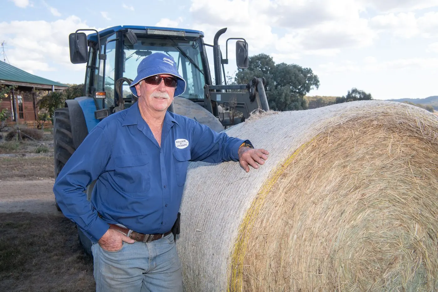
Cattle producer Denis O’Connor, who runs his “Mistletoe” property with a Limousin line over 440 acres in Greta South, has been on the land for 32 years and fears the worst.
He said pressure mounts even further as sheep and cattle producers are being stretched to their limits with prices falling in the last six weeks.
“There are currently some serious concerns for all farmers alike as the pinch of pressure is now becoming very real, with no rain in sight,” Mr O’Connor said.
“We had rain in March this year which prompted a few farmers to plant seed, including us, only to see the gamble fall on it’s head as the dry conditions since that time have killed off crops - losing money on the seed that was spent.
“Cattle, sheep, cropping and agriculture are all suffering in one way or another.
“Hard decisions need to be made in the rural sector.
“Normally our paddocks are full of rye grass, however we can only see dust and dirt for as far as the eye can see.
“Like everyone else we have been obliged to buy in hard feed and will be purchasing corn and grain to sustain our cattle.
“Purchasing hard feed is very limited, prices have increased based on the availability which is also stretching the budget of every farmer.
“Water sources are another issue as some dam levels are critical with a handful of producers seeing roughly six weeks of supply until water will need to be trucked in if we see no significant rainfall between now and then.”
According to the Bureau of Meteorology, weather patterns across southeast Australia have been dominated by multiple slow-moving high-pressure systems.
This is a continuation of weather patterns seen throughout much of 2024.
These slow-moving high-pressure systems have resulted in persistent warm and dry conditions, with fewer outbreaks of cold air or rain-bearing weather systems.
State of the Climate 2024 has indicated that there has been a shift towards drier conditions across southern Australia, especially for the cool season months from April to October.
While some areas can have above average rainfall in some seasons, for southern Australia as a whole, April to October rainfall has been below the historical 1961–1990 average in the last 30 years since 1994.
The declining trend in rainfall is associated with a trend towards higher surface atmospheric pressure in the region and a shift in large-scale weather patterns.
There have been more highs, fewer lows and a reduction in the number of rain-producing lows and cold fronts.
Over the southern Australia region, there has been an increase in density, and therefore frequency, of high-pressure systems across all seasons.
Sea surface temperatures remain much warmer than average in the Australian region; El Niño–Southern Oscillation and Indian Ocean Dipole are neutral.
The latest weekly SST analysis (ending May 20) shows warmer than average waters around most of the Australian coastline, reaching up to 3 degrees Celsius above average to Australia's south-west, south and east.
Global SSTs remain substantially above average.
Each month in 2025 has been the second warmest recorded for its respective month, only slightly cooler than 2024.
Overall, a drier and warm winter is forecast based on the current conditions with no autumn break in sight.