PHOTO
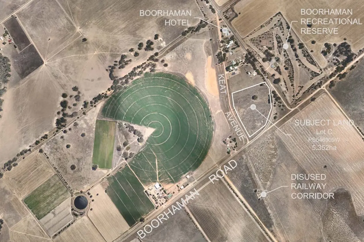
Plans are before Wangaratta council for an 11-lot residential subdivision on Boorhaman Road, just south of the local pub.
The application by McPhail Properties Pty Ltd refers to 5.352 hectares sited in a Township Zone and it’s proposed that land sizes will range from about 4003m2 to 7321m2.
Boorhaman Road abuts the property to the east and south and Keat Avenue (an all-weather gravel road) to the west.
The land is generally flat in nature and drains naturally from east to west across the site.
There is also a five-metre-wide drainage easement that traverses the property from east to west.
The application notes that existing drainage patterns downstream of the subject land will not be affected by the proposal but enhanced by an upgrade to existing swale drains.
There would be only one access point for the entire subdivision directly onto Boorhaman Road.
Applicants also note that the driveway location has been chosen to avoid the removal of native vegetation and to reduce the impact of the subdivision on adjoining minor roads.
They remark that council may consider reducing the speed limit from 80km/h to 60km/h within the town.
The development’s location would be within walking distance to a range of community facilities located throughout the township of Boorhaman.
Applicants note that the development is appropriately located as to promote opportunities for active modes of non-car dependant transport and furthermore is developed and designed to allow for the safe movement of pedestrian traffic within and between neighbourhoods.
The location is coined as a natural extension of the Boorhaman township and the proposal is consistent with the Wangaratta Planning Scheme.
A planning permit for the site at 1473 Boorhaman Road will not be decided upon by council before 2 September.