PHOTO
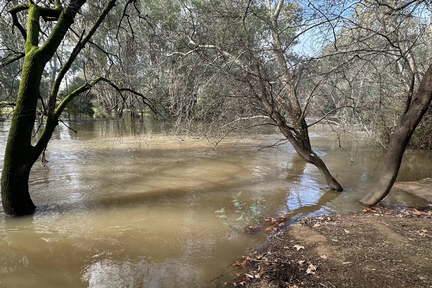
The Ovens River at Wangaratta has been on flood watch since Monday as river heights begin to steady after the weekend downpour.
As of 2pm Tuesday, VICSES issued a minor flood warning indicating it was possible river heights could reach the 11.9m threshold on Tuesday evening into Wednesday.
A 21.9mm downpour with peak wind gusts of 74km/h was recorded at the Bureau of Meteorology’s Wangaratta Airport gauge overnight Friday into Saturday morning.
A further 12mm was recorded from Sunday to 9am Tuesday.
As of 1pm Tuesday, the Ovens River at Wangaratta was steady at 11.52m.
Minor flooding occurred on the King River downstream of Lake William Hovell and Docker Road bridge sites on Sunday, but river levels were falling.
The Docker Road Bridge river level peaked just below moderate flooding at 3.89m on Monday night before dropping to 3.79m at 1:40pm Tuesday.
There is no updated river height available since minor flooding was recorded at Lake William Hovell.
Rural City of Wangaratta Council closed off the Ovens River bike path and riverside carparks on Tuesday due to flood risks, restricting access to Sydney Beach, Bickerton Street, Baker Street, Templeton Street boat ramp and the Northern Beaches.
Reopening will occur when river levels subside sufficiently.
The VICSES advised the community to be prepared to act if the situation changes.
Wangaratta’s forecast for the rest of the week showed a low chance of rain and maximum of 15 degree days according to The Bureau.
Monitor weather warnings, forecasts and river levels at the Bureau of Meteorology website, and warnings through VicEmergency website/app/hotline.
You can find out more about Wangaratta’s flood guide via the link: https://www.ses.vic.gov.au/plan-and-stay-safe/flood-guides/rural-city-of-wangaratta#wangaratta-local-flood-guide.
For emergency services, call the SES on 132 500.